
Why a map, not a book?

Instant overview of your walks

If you're thinking of walking Budleigh to Beer, say, you can see instantly that the first half is pretty easy, but the second half much less so. On the approach to Beer, there is a Tricky Bit (explained in more detail elsewhere on the map). Then the next stage, beyond Beer, coloured purple, is somewhere between the first two for effort. Note the out-of-town car parks and helpful bus routes, too.

Get key details at a glance

You can see here the six effort ratings used to categorise the 37 stages on the SWCP east sheet, from Easy to Tough. As well as conveying the key features of the path itself, the map marks lodgings at the split-points between stages, diversions along the way, ferries you need to cross rivers, Tricky Bits and isolated car parks – great for people planning to use the two-car trick. All helpful bus services are shown, clearly categorised.


Works walking west or east 

When walking the SW Coast Path, covered by our first WalkPlanners, the tradition is that you start at Minehead and finish at Poole Harbour. So deep rooted is this tradition, that all existing guide-books are based on the assumption that you will follow it. But if you don't need the step-by-step directions of a guide-book (and no-one does, actually) you can walk any stage in either direction, and our stage info makes no assumptions about which you choose. If you are walking the path in bits, this flexibility can be very helpful.

Great for using buses and cars

Unless you are walking your trail from end to end with a tent on your back, you're quite likely to want to make use of buses or remote car parks, or both. One or two existing guide-books mark car parks on their detailed walking maps, but they can't handle bus routes because their maps don't reach far enough inland to show the routes in a meaningful way. On our 1:200k map, we can do that, with services categorised and colour-coded, and routes numbered.

Smaller, cheaper, lighter

Of course, much of your walk planning is likely to take place at home, where it's no problem to refer to hefty books or even a three-book or four-book series. But you might find it helpful to do some planning as you go, and in that case the pocket size and minimal weight of our WalkPlanners (currently 65g) will be valuable. As for price: SWCPA Official Guide £20; National Trails Official Guide set £60; Trailblazer guides set £41.

Bonus! Mark your progress ...

If you want to keep a record of your progress on the coast path, you can pay the SWCPA £25 for a scratch-off map. Or you can get your highlighters out and colour in the white bits of the coastal line on our WalkPlanner. The stage descriptions have space for brief notes – eg when you walked it an with whom.

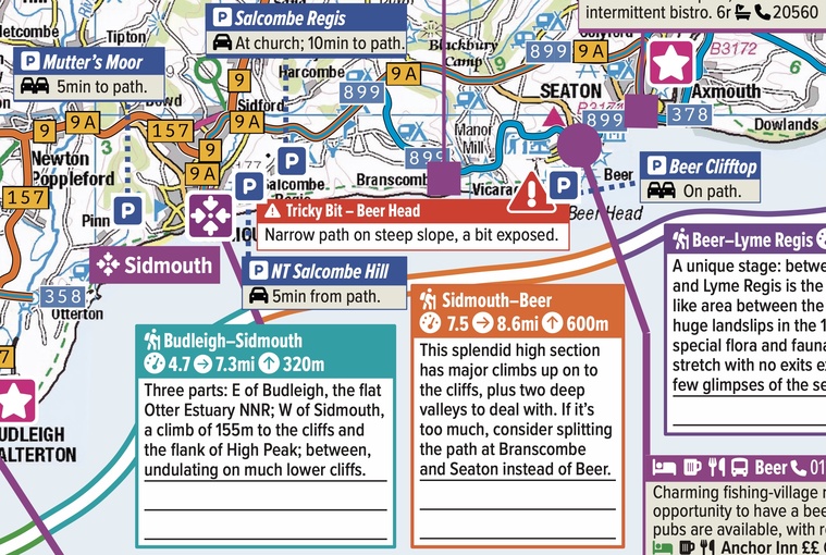
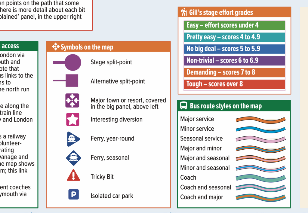
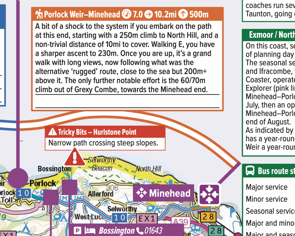
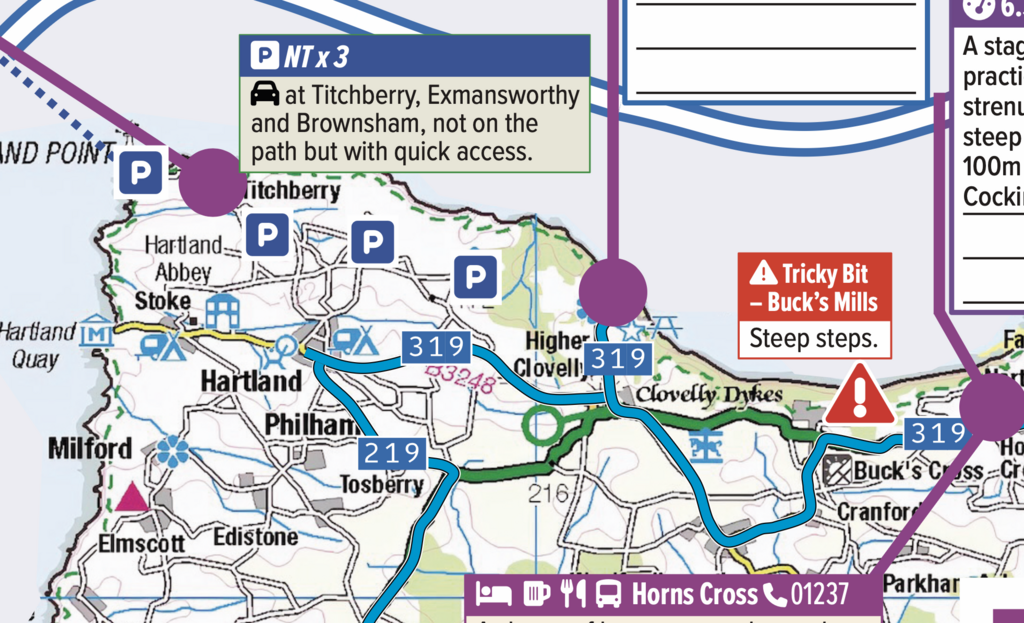
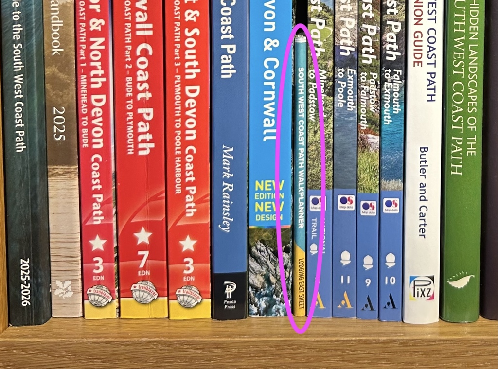
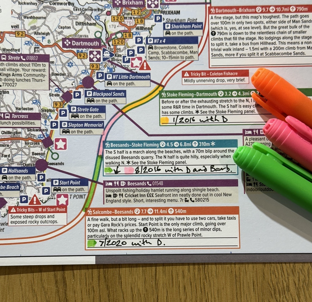
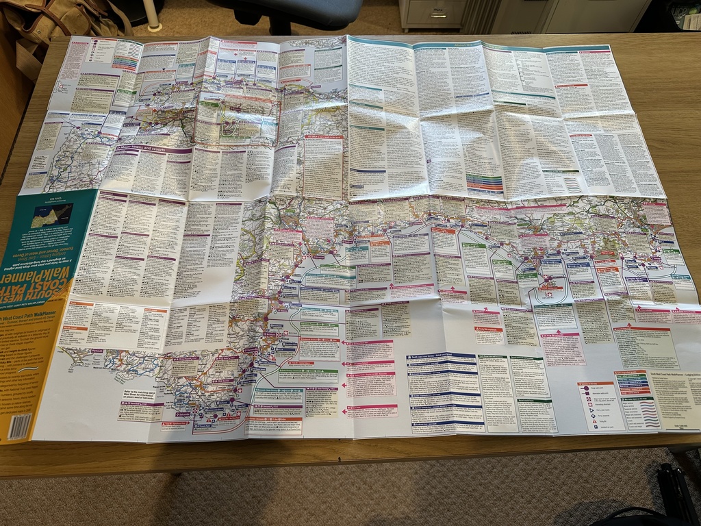
Our first WalkPlanners are guides to England's wonderful 650-miles-long South West Coast Path. The very first, covering the eastern part and focused on overnight stays in lodgings, was published on 1 December 2025. It will be followed early in March 2026 by the matching west sheet, and then in the spring by a whole-path sheet for campers. Here are some images of the SWCP WalkPlanner, Lodging Edition, East Sheet.


If you are planning day-trip walks, of course, it doesn't matter whether you use the lodging or camping edition – but they will have differing stages, depending on where guest-houses and campsites are to be found.


The Order Now button in the nav bar will take you to the Guide Editors shop, where you can buy any WalkPlanners that are published, as well as our stock of ski resort guides.


FAQ

Find the answers here.

As at 5 December 2025:
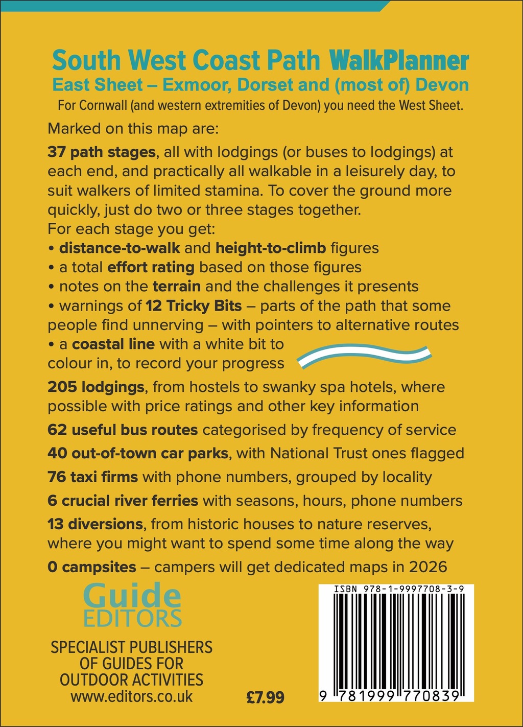
South West Coast Path WalkPlanner – Lodging Edition – East Sheet

March 2026:
South West Coast Path WalkPlanner – Lodging Edition – West Sheet

South West Coast Path WalkPlanner – Lodging Edition – both sheets together in a cardboard sleeve

Our sales representatives are pushing the first WalkPlanner to bricks-and-mortar bookstores, online bookstores, outdoor equipment shops such as Go Outdoors and anyone else who might like to sell the map. And you can buy direct from us via the Guide Editors website.

If the WalkPlanner concept is well received, we'll revise them annually. The only SWCP guide-book that is revised annually is the SWCP Association Official Guide. We are planning to offer updated editions to buyers of the existing edition at a very special bargain price. To be informed of how this will work, you need to sign up to our mailing list on the Guide Editors website.

Once we have the Lodging and Camping Editions of our SWCP WalkPlanner in the bag, we may move on to other long-distance trails, or indulge ourselves in focusing on the English Lakes for a bit. To be kept informed, sign up to our mailing list at our main website.

Press downloads

Front cover JPEG 443.33 KB

Back cover JPEG 680.75 KB
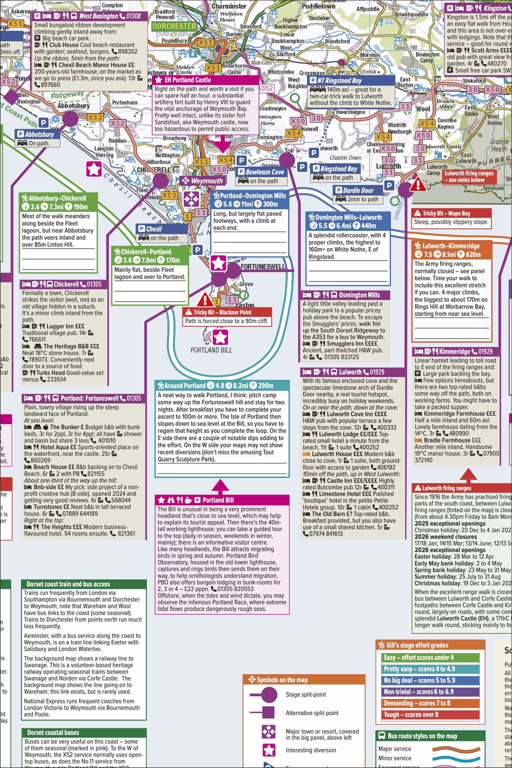